Archive | Technology RSS feed for this section

OneBusAway (beta) is Made Available to MARTA Riders

5 Mar

Happy Tuesday!

OneBusAway helps MARTA riders know when the next bus is coming.

A couple of months ago, MARTA released their real-time tracking info for buses.  Now some cool apps are starting to hit the market.  This is one that I think is particularly useful.  It’s called OneBusAway and it has been opened for beta testing by students/researchers at Georgia Tech.  It consists of a website, iPhone app, and Android app.  The apps take a little editing of settings to get to work right for Atlanta, but it’s a pretty cool app once it is setup.  It is based off of the OneBusAway instance originally deployed in Seattle, WA.  

For more information about how to access the website and apps, go to http://onebusaway.gatech.edu.

Five Reasons I’m Optimistic about Atlanta

25 Feb

Happy Monday,

Living as an urban enthusiast in Atlanta can be difficult.  Apparently parks, museums, walkability, safe cycling routes, good food, fun pubs, and cultural diversity are things that most people around here seem to not enjoy.  Because of this, it’s easy to get discouraged in this town.  To help myself out of the doldrums, I devised a list of 5 things that make me hopeful for this city.

1) The Downtown Streetcar is Moving Forward

The City of Atlanta is installing it’s first streetcar line 64 years after the last streetcars were removed from Atlanta streets.   The streetcar lines connects Centennial Park, Fairlie-Poplar, Downtown, and the Old Fourth Ward at the MLK Center.

I am hopeful that this project is a success.  A successful streetcar line would lead to further expansion, more connection points to MARTA, connection to the Beltline, and eventually a true streetcar system for the City of Atlanta.  Such a system would provide a level of car-free mobility that Atlanta hasn’t seen in over half of a century.

The task is tall however.  Much of the area where this streetcar is to be installed is blighted, and there is heavy risk in staking this much capital in an “up-and-coming” neighborhood .  If the streetcar proves unsuccessful in improving the economy and livability in the service area, especially the areas within a few blocks of the interstate, then naysayers will cite that failure as hard evidence that Atlanta is not fit for streetcars.  On the other hand, if the streetcar is successful and makes a large positive economic impact on the downtown communities, then it will be impossible to deny that a streetcar network should be expanded throughout the city.

As an aside on this topic, I must admit that I’m worried about headways.  First impressions are important for new systems.  If people are unsatisfied with their first trip, then they may never give the system another chance.   Because of this, I am worried about the reported 15 minute headway projected for this project.  One streetcar every 15 minutes is not very frequent.  With such a short rail line, I would more likely walk than wait 15 minutes for service.  It only takes 2 streetcars to operate at 15 minute headways on this line.  The City of Atlanta owns 4 street cars.  In order to make a solid first impression, these streetcars should operate at no more than 10 minute headways.  If ridership is low, then headways can be increased.  

2)  Marta Releases Real-Time Data

Back in October, MARTA released its real-time bus data and the GTFS schedule data for its buses and trains.  Since then, the real-time bus feed has been continually refined and improved by the hard-working people at MARTA in order to give consistent and accurate updates about bus locations.  I know of several 3rd party developer teams who are working to release apps that take advantage of this data.

In the coming weeks, I hope to see good apps hitting the market.  Real-time bus data will have a dramatic effect on the practicality of MARTA.  We all know that many of MARTA’s routes suffer from very long headways.   Some buses operate at 40-60 minute headways, even during peak weekday hours.  In addition to the long headways, the buses are often late or early depending on the notoriously unpredictable Atlanta traffic.

It is very stressful to be waiting at a bus stop, with no shelter, no sidewalk, on the side of a 7 lane highway, in July heat or February freeze and wondering if the bus is ever going to show up.  Is the bus 10 minutes late or did it come early?  Well, real-time data can’t fix all these problems, but at least you would  know where the bus is and when it is coming.  Then you don’t have to wait at one of our city’s lovely dignity-free MARTA stops while being stared at by every driver passing you by.  You can walk out to the stop moments before your bus arrives and forget all the extra stress and associated nonsense.  If the bus is going to be 10 minutes late, I would rather spend that time inside the Starbucks.

3)  Cycling Infrastructure is Improving

Atlanta is getting some good momentum on the bicycle infrastructure front.  There seems to be a consensus among advocates and city politicians and planners that Atlanta needs to seriously embrace bicycling as a legitimate mode of transportation.  This is evidenced by current and upcoming bicycle projects that will connect important and practical locations around town.

For instance,

  • Ponce de Leon is getting separated bicycle infrastructure this summer.  This will allow bikers to easily travel from Peachtree St. and the North Ave MARTA Station to the Beltline, Ponce Market, and the Whole Foods shopping center.
  • 10th Street is also getting separated infrastructure to safely move bikers between Midtown and the Beltline.
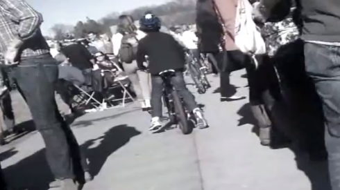
  • Juniper Street is getting a total overhaul.  The overhaul will lead to fully separated bike paths, intersection improvements, and vastly improved sidewalks.  It will be a great walkable complement to Peachtree Street one block to the west, and it will also serve as a much needed southbound bike route through midtown.  I don’t have a link to the project page, but the image above is from an open house held earlier this month describing the project.
  • In addition to these projects, a host of other projects that extend far beyond midtown, and totaling $2.5 Million, are described on the Atlanta Bicycle Coalition website.

4)  Start-Up Culture in Atlanta is Gaining Ground

The Atlantic: A Visual Guide to Atlanta’s Startup Scene

OK, this is the one entry of the five that is not transportation related.  Efficient transportation and a vibrant urban setting are impossible and useless without a strong economy and jobs for Atlantans.  I would love to see a strong start-up culture here.  Atlanta has a lot going for it in this area.  We have great universities (e.g., Georgia Tech, Georgia State, Emory, the schools at the Atlanta University Center).  Atlanta is affordable.  It is much more affordable to live an urban lifestyle in Atlanta versus other similar cities.  We have a ridiculous airport that makes Atlanta a great place to base a national or international company; it’s easy to get anywhere from here. And, we are also home to more than our fair share of Fortune 500 companies.

Atlanta seems to have the necessary pieces for a strong start-up scene and that is being recognized around the region and country.  More start-ups were funded in Atlanta last year than any other southern city. (We don’t count Texas because they aren’t real southerners.)   With the ongoing success of ATDC, FlashPoint, Atlanta Tech Village, Hypepotamus, and countless other start-up accelerators and services, I expect Atlanta’s tech start-up scene to start making more and more noise nationally and internationally.

5)  BeltLine Popularity is Out of Control

Nobody goes to the BeltLine anymore.  It’s too crowded.  

beltline

The popularity of the East Side Trail shows just how much latent demand there is for walkable places in this city.  So much so that some people are beginning to fight over the limited pavement space on the EST, for instance, the guy discussed in this article in Curbed.  Overcrowding is a problem.  But it’s a good problem to have and much better than the alternative.  It’s oddly refreshing to hear people griping about Atlanta traffic that does not involve cars.  It’s actually kind of mind-blowing.

This popularity of this section of the BeltLine has led to the stores and restaurants adjacent to the BeltLine to transform what used to be their rear entrances, parking lots, and dumpster sites into welcoming patios and front entrances to accommodate this new source of customers.  What used to be vacant industrial sites around the East Side Trail are now prime real estate for Atlanta’s latest awesome amenity.

The popularity of the BeltLine and the reaction of the adjacent businesses gives me hope that more similar developments will also be well received.  The East Side Trail is just a small start for building a thorough network of practical cycling and walking paths in Atlanta.  I hope that this section of the BeltLine will eventually have transit connecting it to the downtown streetcar and potential midtown streetcars in the future.  Can you imagine having a streetcar circuit that connected the East Side Trail, the downtown streetcar, 10th street, 14th street and the West Midtown area on Howell Mill?  That relatively small circle would be a fantastic streetcar network for midtown and downtown Atlanta.  I might be dreaming a bit, but it’s fun to  imaging having that type of car-free connectivity in Atlanta.

In other news…

  • Rebecca Serna of the Atlanta Bicycle Coalitions responds to Melissa Carter‘s ill-informed anti-cyclist diatribe.
  • Apparently car rental taxes are being considered to fund transit in Atlanta.  I’m not sure where I stand on this issue, but I do know that it’s absurd that the current rental car tax is used to pay for the Philips Arena.  What in the hell does me renting a car to drive out of town have to do with the Atlanta Hawks?
  • Some new high rises are suggested for Midtown.  Whoopeedeedoo!

Education, debates, demos, and discussion at Transportation Camp South

12 Feb

This past Saturday, TransportationCamp South took place at Georgia Tech.  Innovators from around the City, State, and Region came together for one day of discussions, demos, and education related to transportation in the South.

TransportationCamp South is the latest iteration of a series of TranportationCamp “un-conferences”.  At these un-conferences, people show up with ideas that they want to discuss, demos they want to show off, or debates they want to lead.  They promote these ideas by posting them on large post-it notes, and a very small team of organizers very quickly compiles a schedule of hour-long sessions taking place in a dozen different rooms throughout the day.  If your topic is picked for a particular round of sessions, you lead that session.  If not, you get to attend one of the other awesome sessions selected.  It is essentially a crowd-sourced conference. 

The conference attracts civil and transportation engineers, city planners, computer programmers, advocates, officials, and general enthusiasts of transportation issues.  All these people with varied backgrounds mix and mingle at a wide array of sessions that you won’t find at most conventional conferences.

Photos from TransportationCamp South.  Find these and more on Facebook

This slideshow requires JavaScript.

Session topics cover a wide array categories such as technical demos of real-time transit tracking apps (like OneBusAway, which hopefully will be available in Atlanta very soon), history reviews of freeways and transit in the South, a debate of the role and impact of autonomous cars in urban transportation, and more whimsical topics like “MARTA Pickup Lines”, which sounds silly but is actually a group of transit advocates promoting transit use through humorous and often sardonic social media events called TransitThursdays.  I don’t do Twitter, but I may have to start this week.

Some cool stuff that I got to see and learn:

I now know that the reason that there is so much green space around Freedom Parkway and Inman Park (see the areas inside the orange lines).  It’s because hundreds of homes were bulldozed to make way for an interstate that never came.  Guess who put a stop to that interstate…it was Jimmy Carter.  Guess where the Jimmy Carter Library is, at the intersection of these interstates that never happened.

I got learn more cool history, like the reason that Gwinnett and Clayton have representation on the MARTA board.  It’s because in 1965 they voted YES to the MARTA Act.  The MARTA Act created an agency to plan future transit in Atlanta.  In 1971, Clayton and Gwinnett vote NO to actually funding the transit plan.   So Clayton and Gwinnett are still on the planning board but have no MARTA service because they don’t want to fund it.  Cobb has always been in the NO category.

There was also a demo of some cool apps resulting from MARTA releasing their real-time bus data.  OneBusAway, which was developed at the University of Washington for transit in Seattle, is being tested at Georgia Tech.  I’m hoping that it will be available publicly in Atlanta sometime soon.  It is only a matter of time before a variety of real-time tracking apps are available in Atlanta.  See the image below for a preview (click to enlarge).

I also learned that self-driving cars are going to let us have our cake and eat it too.  Forbe’s says by 2040 self-driving cars will dominate the roads.  This means that anyone who wants to live way out in the country and still work in the city will have a no-hassle commute.  It also means that all the parking and dangerous cars in city-centers will be removed to build Jane Jacobsian paradises.  Finally, transit Utopia.  Or maybe none of that will happen and we’ll live in gridlock hell because toddlers will all of a sudden have cars just like kids have cell phones today.  Who knows?  It was great to hear opinions on how self-drivings cars will impact safety, transit/highway use, land development and vehicle ownership.  Do we really need to own cars once they can drive themselves?  I say NO!  Others say YES!  Maybe we can both win.   Attendees of this meeting decided to continue this discussion with monthly meet-ups.  If you are interested in talking about impacts of self-drivings cars in Atlanta and want to be ahead of the game, drop me a line.  

Bottom line, TransportationCamp South was a fun and educational event.  Far more happened than I care to write about here.  If you want to learn more about it, check out the Facebook page and keep an eye out for TransportationCamp South 2014.  

Atlanta Bicycle Ridership Map!

24 Jan

Back in October, Georgia Tech introduced an app called CycleAtlanta.  The app allows city planners and bicycle advocates know where bicyclists are traveling in order to improve the infrastructure in our city.  Well the early results are in.  Check out the images below to see where cyclists have been traveling in our city.  Keep in mind that this data is pretty raw, but the results are still very interesting.

Click the Pic for a Larger View

City-wide bike patterns. The thicker the line, the more frequent the travel.

There is a pretty strong presence in midtown and downtown Atlanta as well as east towards the Eastside Trail and Freedom Parkway.

Detail of Midtown.

Notice how Spring street has almost no bike traffic and despite the fact that West Peachtree has a dedicated lane, traffic is low there as well.  That’s because the West Peachtree lane is far too narrow to be safe and cars travel very fast on that road. I was surprised to see how many people use Peachtree Street though.  I don’t like Peachtree Street, although I use it very often because it is the safest way to travel North/South across 10th street.

Downtown Atlanta.

There is not as much traffic downtown as I would have thought.  Although, because this is a Georgia Tech app, it should not be surprising that a lot of early adopters ride in midtown.

Eastside.

It is awesome to see how thick and red the Eastside trail is.  That is some solid evidence that building good bike infrastructure will encourage ridership.

This is just the first round of early data coming from CycleAtlanta.   Thanks to Chris Le Dantec and his team at CycleAtlanta for putting this data together.  It is very exciting to see some tangible evidence of Atlanta’s cycling presence.  I look forward to more results and data coming out of the project in the future.

TransportationCamp South is Coming to Atlanta!

24 Dec

TransportationCamp South is coming to Atlanta on Saturday, February 9th!

It’s an exciting time for innovative transportation in the Southeast.  The Atlanta Beltline is moving forward and MARTA has released their real-time vehicle location data to the masses.   Chattanooga and Charlotte have created public bike sharing programs.  Charlotte is expanding their already successful streetcar and transit system.  The list of projects goes on and on.

This is a great time for innovators, transportation professionals, and enthusiasts around the South to share our ideas and shape the future of transportation and urban design in our cities and suburbs.

“The sixth TransportationCamp to date and the first to be held in the Southern U.S., TranspoCamp South will bring together thinkers and doers in the fields of transportation and technology for a day of learning, debating, connecting, and creating.”

Read more and keep up-to-date on facebook.

Cyclists! Stand Up and Be Counted!

21 Oct


A great new app is now available for bicyclists in Atlanta.  It is called Cycle Atlanta.  This isn’t just another bicycle route tracker.  This app gets bicycle lanes built and infrastructure funded.  It does that by providing hard data to city planners and politicians about WHERE cyclists travel, WHEN they travel, and WHY they travel.

When planners and bicycle advocates go to City Hall and Capitol Hill, this data will make it much easier for them to persuade law makers to fund infrastructure. It will also help city planners build the infrastructure that is most needed in Atlanta and build it in the most effective locations.

How can you help?  Download this app (available for both iPhone and Android). Downloading this app will allow you to record any bicycle trip you make and send that trip data to the Georgia Tech researchers managing Cycle Atlanta.

The app is very simple to use. The first screen that you see has a large button on top to Start Trip! (As well as a list of previous trips that you have submitted.) Then you just ride.

As you ride your path is recorded and statistics about speed are displayed to the user. I suppose if you had a mount on your bike you could watch this live. I’m not sure that I would recommend that. I just keep my phone in my pocket.


When your trip is over, hit finish and you will see the following menu. Here you can tell the planners what sort of trip you were taking (Shopping, Work, Social, etc.) and you can even leave comments about the trip. I have used this comment field to suggest locations for bike lanes and report intersections where the induction loops do not detect bicycles.

Finally, your trip map is shown to you with some basic statistics and the points where your location was recorded. This is the exact sort of information that can really improve cycling routes in Atlanta. For instance, look at the map below. Notice that I took a very indirect path between by origin (green thumbtack) and destination (purple thumbtack). This is not the route that I wanted to take.  It was the shortest route that I deemed acceptably safe. I left a comment to this effect for the planners.

Anyone who cycles in Atlanta should download this app. The more people that use this app, the easier it will be to find funding for bicyclists and the more information planners will have about where to build infrastructure.

Let the planners know that you are out there on your bike.  Millions upon millions of dollars are spent planning for automobile traffic.  This app levels the playing field a bit.  By crowd-sourcing this information, bicyclists don’t necessarily need the million-dollar studies to build proper infrastructure.  It lets us actively participate in the planning process by telling the planners and politicians exactly where we go and exactly what we need to improve our experience.  

Cyclists, download this app. Use it.  Stand up and be counted!

In other awesome news:  MARTA has opened up its schedule data and real-time data to the public.  Expect many awesome apps coming to Atlanta very soon.

The Transportation Tax – Truth, Lies, and Gridlock

23 Jul

More on the upcoming Atlanta TSPLOST…

PolitiFact weighs in on the truthiness of arguments from both sides.


Where it All Went Wrong: Cross post from Atlanta Magazine.

23 Jul

This is a interesting read on the history of MARTA and Atlanta transportation from Doug Monroe at Atlanta Magazine.  This guy doesn’t pull any punches.

Read it here: “Where it All Went Wrong

Self-Driving Cars: ‘Freedom’ or ‘More of the Same’

2 Feb

That last post got quite a response.  It was really fun reading all the comments.  Thanks to everyone for keeping the conversation civilized and productive.

One recurring theme that kept appearing in the comments section was that of self-driving cars.  If self-driving, autonomous, driverless (whatever you want to call them) cars still seem like science fiction to you, they probably won’t seem that way for long.  I am not even going to make the argument about whether or not they are coming.  They ARE coming!  Google seems to have nearly perfected the technology behind it.   At this point, it is only a matter of sorting out the legalities of introducing millions of self-driving cars onto our roadways.

Just for fun, here is a short TED Talk on Google’s cars.  The technology is absolutely awe inspiring.

If we assume that these cars are coming, the next question is:  How will this change our driving habits and our lives?  I have two very different expectations of what will happen when Ford, Chevy, Toyota, and all the other big manufacturers start putting out self-driving cars.

First the optimistic expectation.  In the optimistic future, self-driving cars will provide a complete paradigm shift in the way we think about transportation.  If self-driving cars become the main form of transportation, there is no practical reason to own a personal car.  Think about it, when cars are in storage approx. 95% of the time, that is a wasted resource.  This is the reason that we require so much parking.  What if during that 95% of downtime, the cars were off handling other trips like driver-less taxis?  When you needed a car, you summon it and it appears Batmobile style within seconds, or at the worst a few minutes.

How great would that be?  You no longer have to worry about maintenance or parking and you get to split the cost of the car with everyone who uses it.  Parking would free up all over the city because it is no longer needed.   You don’t get stuck with a single car.  If you need a 7 person SUV, you get it.  If you need a pickup truck, you get it.  If you need a single passenger vehicle, you get it.   And since you aren’t tied to your car, you might even walk more.  Previously you would drive that 1 mile to the grocery store, now you may walk it and simply opt for a ride back.  The sunk cost of owning and operating a car would vanish.  You would only pay for what you actually use.  This might actually prompt alternative transportation use.  It is hard to justify taking the train, when I have already sunk 20 grand into my car.  If enough people exchange a few car trips for walking or transit, we may even see a return to more walkable communities.  This would, of course, lead to even more people choosing walking and transit.  I can really see some positive momentum coming from intelligently used autonomous vehicles.

Now for the pessimistic vision of the future.  Nothing changes.  It is the same model that we have now.  Every single person owns his or her own car.  We still have to store all those cars 95% of the time and the only real difference in the commute is that you can watch cartoons on the way to work instead of driving.  Granted safety would be greatly improved and maybe some increase in efficiency on the highway.  Although as long as some people are still driving themselves mixed in with the driver-less cars, not much efficiency can be gained.

What would really happen in this scenario is that urban sprawl would increase dramatically.  When people are deciding on where to buy a house, they are weighing cost per square foot against commute times.  People who currently tolerate a 45 min. trip to work in exchange for the 6000 square foot McMansion way out in the exurbs, can now really spread out.  Instead of driving 45 min. to work, you can move 2 hours away from work and sleep in your car on the way in each morning.  Hell, why not live 8 hours away and do all of your sleeping in your car. (OK maybe that is a little crazy)

 Each time a new mode of transportation is introduced (bikes, trolleys, trains, cars, highways, etc.)  our cities change shapes.  Make no mistake, self-driving cars will not be a simple improvement over our current system.  They will have a dramatic effect on the shapes of our cities.  Ultimately we will probably have a mix of both the pessimistic and optimistic views.  After all, what is pessimistic to me may be optimistic to someone else.  This is OK, as long as the net effect is an increased quality of life in the towns and cities where most of us live.

EDIT:  The blog Narrow Lanes has an interesting post on driver-less cars with more examples and a skeptical POV from someone who doesn’t want to lose the joy of driving by turning control over to machines.  It is worth a read.